
Page 1094 - Proceedings Collega2023
P. 1094
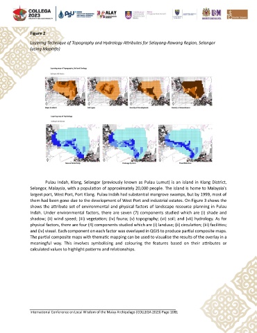
Figure 2

               Layering Technique of Topography and Hydrology Attributes for Selayang-Rawang Region, Selangor
               (using MapInfo)


                       Pulau Indah, Klang, Selangor (previously known as Pulau Lumut) is an island in Klang District,
               Selangor, Malaysia, with a population of approximately 20,000 people. The island is home to Malaysia's
               largest port, West Port, Port Klang. Pulau Indah had substantial mangrove swamps, but by 1999, most of
               them had been gone due to the development of West Port and industrial estates. On Figure 3 shows the
               shows the attribute set of environmental and physical factors of landscape resource planning in Pulau
               Indah. Under environmental factors, there are seven (7) components studied which are (i) shade and
               shadow; (ii) wind speed; (iii) vegetation; (iv) fauna; (v) topography; (vi) soil; and (vii) hydrology. As for
               physical factors, there are four (4) components studied which are (i) landuse; (ii) circulation; (iii) facilities;
               and (iv) visual. Each component on each factor was overlayed in QGIS to produce partial composite maps.
               The partial composite maps with thematic mapping can be used to visualise the results of the overlay in a
               meaningful  way.  This  involves  symbolising  and  colouring  the  features  based  on  their  attributes  or
               calculated values to highlight patterns and relationships.


               International Conference on Local Wisdom of the Malay Archipelago (COLLEGA 2023) Page 1081