
Page 1101 - Proceedings Collega2023
P. 1101
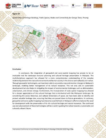
Figure 10

               Spatial Map of Heritage Buildings, Public Spaces, Nodes and Connectivity for George Town, Penang


               Conclusion
                       In  conclusion,  the  integration  of  geospatial  and  socio-spatial  mapping  has  proven  to  be  an

               invaluable  tool  for  landscape  resource  planning  and  cultural  heritage  preservation  in  Malaysia.  This
               multidisciplinary  approach  has  allowed  for  a  more  comprehensive  understanding  of  the  complex
               relationship between the natural environment and human society in this diverse and culturally rich nation.
               Through geospatial technologies, we have been able to accurately map and monitor changes in Malaysia's
               landscape,  enabling  better  management  of  its  natural  resources.  This  not  only  aids  in  sustainable
               development but also helps in mitigating the impact of environmental challenges such as deforestation,
               urbanisation, and climate change. Furthermore, the incorporation of socio-spatial mapping has allowed
               for a deeper appreciation of the cultural heritage that is intertwined with the Malaysian landscape. By
               considering the social, historical, and cultural dimensions of space, we have been able to identify and
               protect valuable heritage sites, ensuring that they are passed down to future generations. In summary,
               geospatial and socio-spatial mapping have become essential tools in Malaysia's efforts to balance the need
               for development with the preservation of its rich cultural heritage and natural resources. The continued
               use and advancement of these technologies will be crucial in guiding the nation towards a sustainable and
               culturally vibrant future.


               International Conference on Local Wisdom of the Malay Archipelago (COLLEGA 2023) Page 1088